Mining and Mineral Exploration
Subsurface intelligence for smart exploration and mining operations.


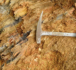

The MUD® system penetrates ground cover and overburden to detect and model bedrock formations, geological structures, faults, and contacts hidden deep beneath the earth's surface. The structures and alterations with the highest probability of mineralization become targets.
MUD® empowers the mining industry to focus on environmental stewardship with accurate monitoring of terrain changes potentially caused by mining activities.
MUD® detects, models and monitors subsurface and underwater movement, where tailings dam stability is at greatest risk.
Deepen your discovery capacity
MUD® technology offers precise and deep subsurface intelligence to detect mineral deposits hidden beneath the earth's surface. By mapping subsurface structure, even in extreme and remote environments, exploration companies can locate and model less apparent, deeper and buried deposits.
By expediting operations, MUD® lowers exploration costs so valuable resources can be efficiently located and extracted, leading to increased profitability and a reduction in environmental impact.
EXPLORE
Narrow your original search areas to prospective targets, extract anomalous features using a 3D modeling geospatial technology that works for surface and subsurface deposits.
DESIGN
Detect subsurface structure and geohazards that impact engineering and design planning for pits, storage and processing facilities, and other critical infrastructure.
MODEL
Visualize bedrock formations, structures and geological faults, outcrops, and contacts at the surface and subsurface over large and difficult to access areas.
MONITOR
Remotely monitor the impact of underground and underwater structural movement on assets and the impact of industrial activities on the environment.

CASE STUDY
Explore the earth's subsurface
from space
Auracle and Alerio Gold joined forces to use MUD® to produce new geographic and geological information to refine and prioritize targets for future exploration programs at Alerio's Tassawini Gold Project, located in a heavily vegetated rainforest in Guyana.

Sustainable resource management
3D models of the subsurface and underwater provide an added data layer of information that improves operational efficiency through discovery of hidden risks and opportunities.
Create value with a unified data set
Create value with new, user-friendly 3D maps and models that transform company spatial data into one unified data set, with fused dissimilar drill, geological, geochemistry, and geophysics data.
Satisfy environmental stewardship
Bring down the cost of deeper discoveries year round, through all weather, day or night, without the environmental risks often associated with traditional exploration activities.


