A New Era in SAR Satellite Remote Sensing Technology
- Auracle Geospatial

- Jul 15, 2025
- 2 min read
What comes to mind when you picture a satellite image?
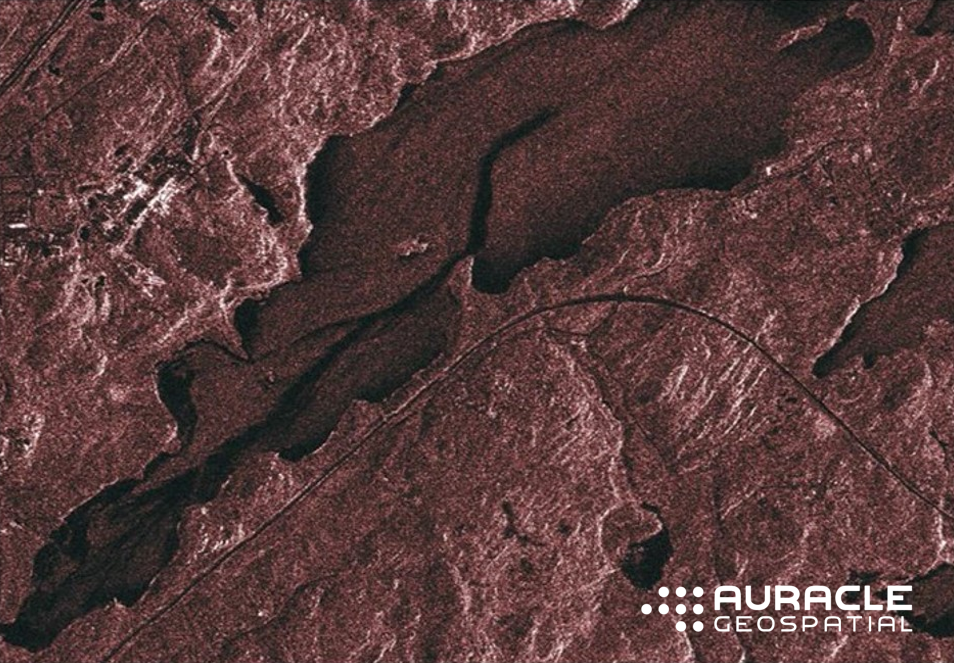
When most people imagine a satellite image it’s something like this:

This is an optical image of an industrial site (on the left) and transportation routes (on the right) separated by a large, deep lake. Note the small island within the lake.
Optical remote sensing image data is generally well known because it has been on the commercial market for a long time. Optical images represent the colorful and visible appearance of objects, similar to what our eyes perceive. Using “passive sensing,” optical satellite sensors work by detecting sunlight reflected from the Earth’s surface, with each spectral band of light containing different information about the Earth’ surface. Multiple spectral bands are combined into a single image of the Earth’s surface.
But optical images aren’t the only way to observe the Earth from space.
Synthetic Aperture Radar (SAR) has been gaining attention for its capacity to reveal detailed information about what’s happening on the Earth and now with MUD® SAR, what's happening beneath the Earth and underwater.
SAR satellite remote sensing technology uses active radar sensors that send out pulses of microwave energy toward the Earth’s surface and then record the amount of that energy reflected back are interacting with the Earth. Using their own radar signals, SAR systems need no light and operate in any weather conditions and at any me, day or night. By processing these returning signals, a SAR system generates an image with information about the Earth’s surface.
Like an X-ray of the Earth, MUD® SAR revolutionizes how we can visualize, monitor and protect our Earth. MUD® SAR satellite deep penetrating radar technology has pioneered a new SAR era in Earth Observation. MUD® SAR (Mapped Underworld Dimension) advances standard SAR interferometry science to explore the Earth's surface and adds underground and underwater geospatial intelligence to look at what is happening under our feet.
MUD® SAR reaches down to depths of 100m, under the Earth’s surface and underwater through clouds, day and night, to model and monitor entire infrastructure networks.
Like an X-ray of the Earth. MUD® SAR satellite remote sensing technology sees through deep vegetation, soils, ice, snow, overburden and water to provide valuable insights into how what’s happening underground impacts surface conditions and ground movement. It detects hidden underground infrastructure and assets, water courses, and natural and man-made geohazards.
MUD® SAR, with its specialized acquisition and processing algorithms, removes noise and distortion and penetrates the surface to see into the subsurface and underwater. With complete subsurface and underwater data, operators and engineers reveal what has previously gone unseen and may have confidence that all of the data has been included in the MUD® SAR monitoring program.
Fill in the knowledge gaps with complete subsurface and underwater data and see what has previously been hidden from view in your monitoring programs.


Comments